The Regional Map Raises a Simple Question: Why Put Prairie West Here?
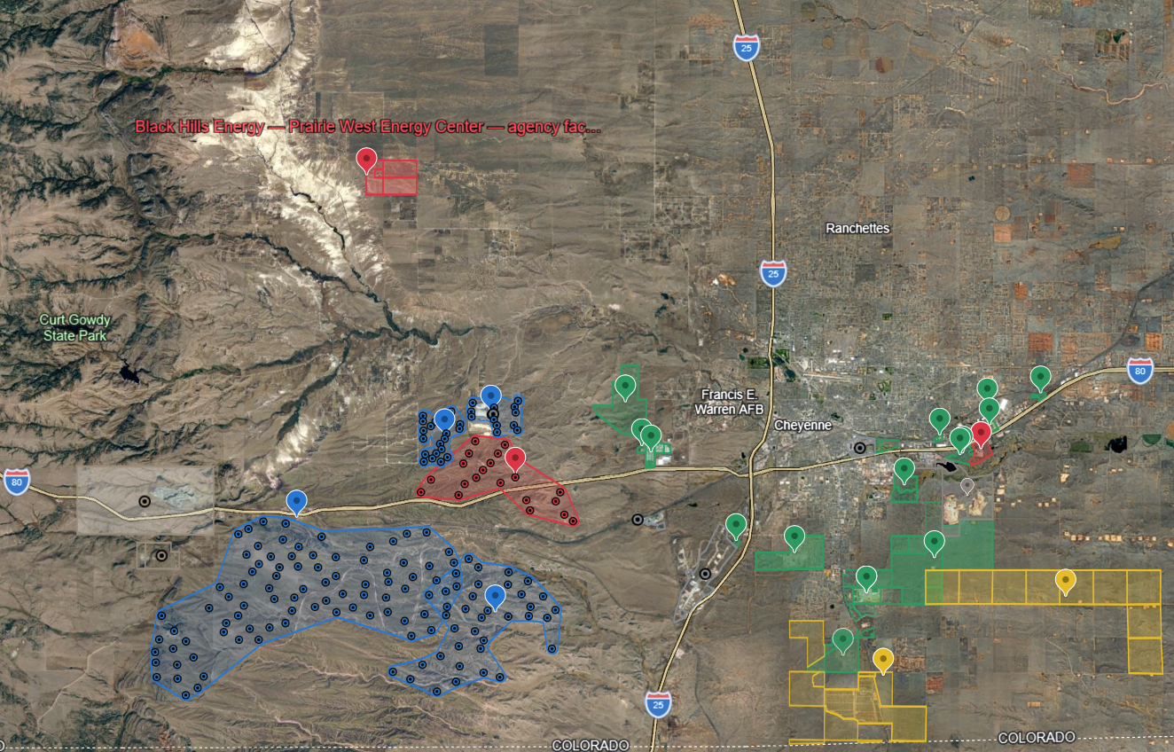
This interactive Google Earth map brings together publicly available GIS, parcel, project, and infrastructure information for major energy, data-center, industrial, and related development across southeastern Wyoming. It includes existing and proposed facilities, project-owned land, development areas, and other regional infrastructure so residents can see the proposed Black Hills Energy — Prairie West Energy Center in its broader geographic context. The contrast is striking: many major industrial and energy developments are located within or adjacent to established industrial corridors and infrastructure, while Prairie West is proposed in a rural area surrounded by homes, agricultural land, private wells, and residential subdivisions. Open the interactive Google Earth map
The map does not by itself determine whether Prairie West should be approved, but it makes the land-use question much easier to understand: why is a new industrial-scale generating facility being considered in this particular location when southeastern Wyoming already contains large areas devoted to energy production, industrial development, data centers, transmission, and other intensive uses?
Laramie County Planning has taken the position that the proposed power-generating facility qualifies as an “essential service utility.” Under the County's interpretation of its land-use regulations, essential-service utilities are permissible throughout unincorporated Laramie County, meaning the use itself is not subject to the type of discretionary county approval that many residents might ordinarily expect for a major industrial development. Black Hills would still be required to comply with applicable site-plan, access, building, floodplain, and other requirements.
That classification also raises an important question for residents. During a telephone conversation with HorseCreekProject.org, a Black Hills Energy representative said the company had not yet started construction because it was still looking for a customer for the power. HorseCreekProject.org has not independently documented that statement in a public filing, so it should be understood as a report of that conversation rather than an established regulatory fact.
If a generating facility does not yet have an identified customer, residents reasonably may ask what “essential service” means in this context. The County's use of that term is a land-use classification; it does not necessarily mean the facility has been demonstrated to be necessary to supply the existing homes and businesses surrounding Horse Creek Road. Public reporting likewise indicates that Black Hills has not identified a customer for Prairie West and that many important project details remain unresolved.
Viewed in that context, the map highlights the concern at the center of HorseCreekProject.org's position: the issue is not simply whether Wyoming needs electricity or whether energy development should occur. The issue is where industrial development belongs. Southeastern Wyoming already has substantial industrial and energy-development areas. Prairie West, by contrast, would introduce major industrial infrastructure into an established rural-residential landscape.
The map is intended to help residents evaluate that question for themselves using geography rather than rhetoric. Zoom out and look at where existing power plants, industrial sites, data centers, wind projects, and supporting infrastructure are located. Then zoom back in on Prairie West and look at the homes and rural land surrounding it.
The distinction is difficult to miss.
Community GIS / Public-Record Mapping — HorseCreekProject.org